
Columbia Basin Analytics LLC
GIS mapping, drone imagery, and spatial analysis for planning, infrastructure, and land management across Eastern Oregon.
Our Services
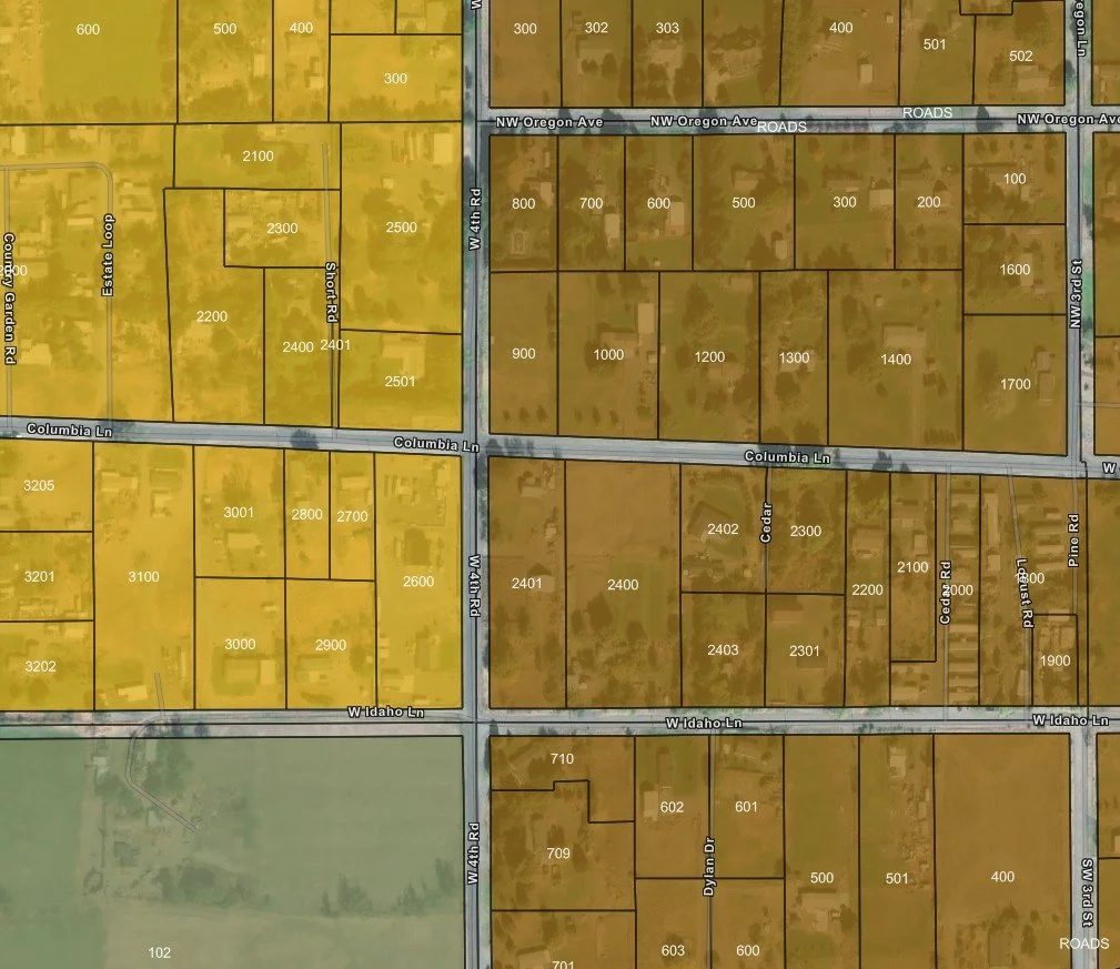
Mapping and GIS Analysis
Custom mapping and spatial analysis to support planning, infrastructure, and land management decisions. Deliverables include high-quality maps, data visualization, and geospatial insights tailored to your project.
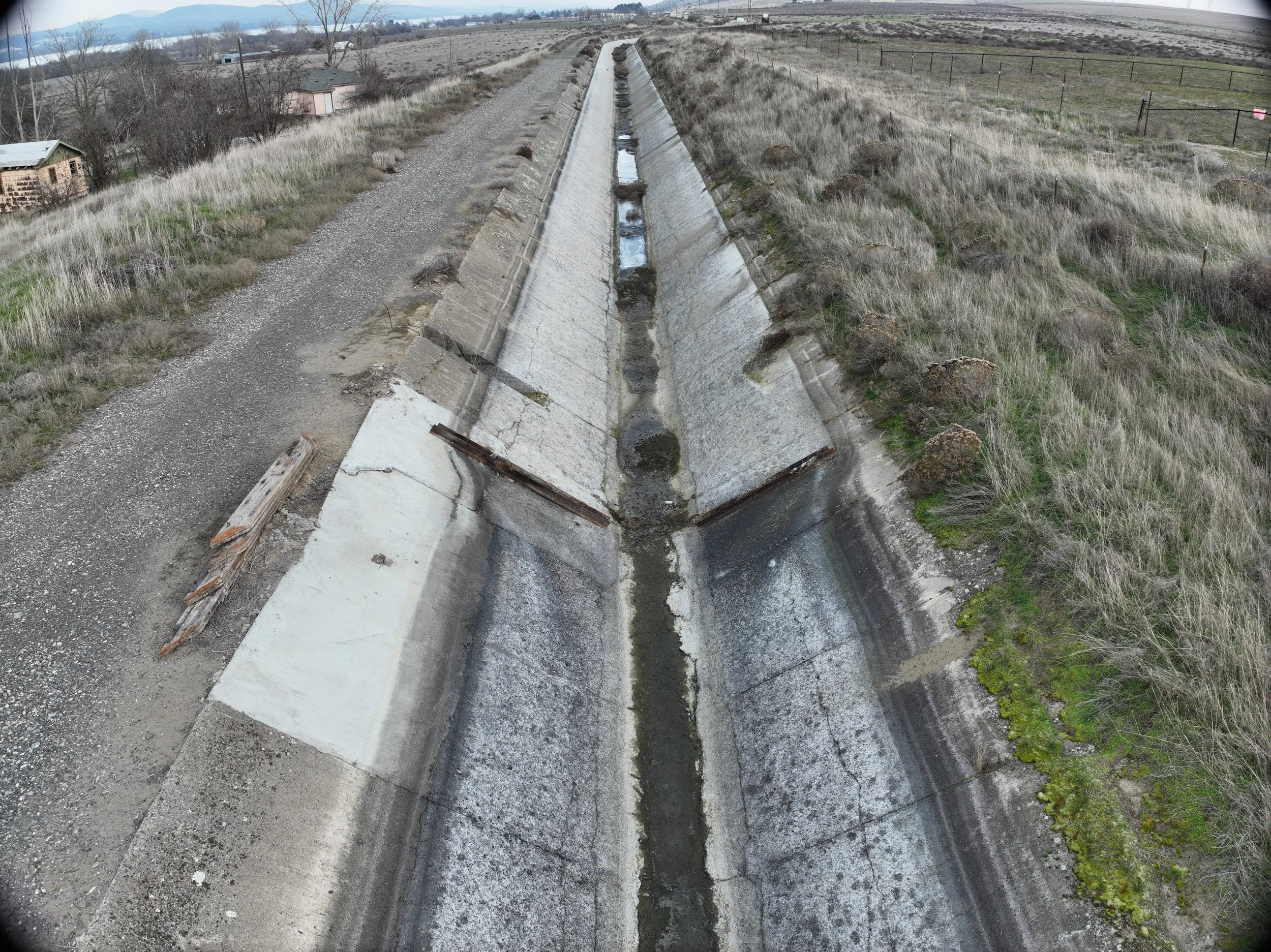
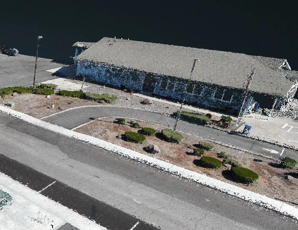
Drone Imagery and 3D Modeling
High-resolution aerial imagery and mapping captured by an FAA Part 107 certified drone operator. Services include orthomosaics, 3D modeling, and site analysis to support planning, inspection, and development projects.
Planning Support
Geospatial support for agencies, districts, and landowners. Services include data collection, map creation for reports, and GIS support for land use, permitting, and infrastructure projects.
About Us
Columbia Basin Analytics LLC is a veteran-owned geospatial services company with over 10 years of experience in GIS mapping, spatial analysis, and data-driven planning support. Based in Eastern Oregon, we are committed to supporting local communities, agencies, and landowners by delivering accurate, reliable mapping solutions tailored to the region’s unique needs.
Stephen, a graduate of Blue Mountain Community College and the University of Oregon, brings both local knowledge and professional experience to every project. Columbia Basin Analytics takes pride in providing dependable service, clear communication, and results clients can trust.

Contact Us
Have a project or question? Fill out the form below, and we’ll get back to you promptly.